Free legal consultation!
The property is considered unique, and not only for the owner himself. The state considers him as such. The authorities are trying to regulate the movement of property and all transactions made with it. Therefore, any real estate, be it an ordinary plot of land, an entire country house or an apartment, must be described in detail, measured and included in a special cadastral register. There, in the system, there will be information concerning the owner. What to do if the plot is not registered in the cadastral register, who does it belong to? Is it ownerless? It's worth looking into it in more detail.
What is cadastral registration and why is it needed?
Cadastral registration is a special system that tracks the condition and ownership of real estate objects. According to the law, any owner is required to register the property he owns. The property receives an individual number, and at the same time a specialist determines the inventory (cadastral) value.
When data is entered into the unified state cadastre, the state automatically becomes a witness confirming the legal rights of the specified owner to the given object, its price, characteristics and location.
Moreover, unregistered objects are considered officially ownerless, that is, without owners. Such real estate cannot be sold/changed/bequeathed or rented out to anyone. Of course, if desired, a citizen can include unregistered property in the text of the will, but then the heirs will have problems with its registration.
The second reason for mandatory registration is taxes. Cadastral registration helps tax authorities evaluate real estate and calculate land tax.
What is a cadastral number and why is it needed?
The cadastral number of a plot is strictly individual.
There cannot be two identical numbers or two different ones for one plot of land. Such numbers are necessary to monitor land plots located within the boundaries of one region or city. The cadastral number indicates that your land is registered with the state, all technical data is entered into a single register. It is impossible to manipulate land if a cadastral number has not been assigned to the land plot. There are two types of land plots: conditionally numbered and unregistered plots.
You can distinguish a conventional number from a cadastral number by the sign that separates the parts of the number. In the conditional number this is the sign “-“, and in the cadastral number it is the colon “:”.
Conditionally, land that is actually registered with the state, but does not have technical data, can have a number. For example, behind No. 555 there is a plot of 50 hectares, but there is no data about it:
- what kind of area
- purpose of land
- presence of boundaries
- presence of buildings
- turning points
Unregistered plots are not listed anywhere, and registration will take considerable time.
Actions if the site is not registered
What to do if the land plot is not registered in the cadastral register? For example, a citizen liked the land. He can independently visit Rosreestr and find out who the owner is and see the main characteristics of the site he likes. What to do if there is no data? Alas, it is impossible to officially carry out a sale transaction without a cadastre. Even when the buyer plans to later register the purchased property.
In practice, people who have some property may not use it in any way for years. What should an interested buyer do?
Why is the land plot not displayed on the Public Cadastral Map?
Why is the land plot not reflected on the public map of Rosreestr? The first, unexpected reason is that you are looking for a plot of land not on the official public cadastral map, but on a duplicate website, which, as a rule, offers paid services and information of very dubious quality. You can go to the “Public Cadastral Map” section from the official page of the department https://rosreestr.ru or via the direct link https://pkk5.rosreestr.ru. The second reason is that your land plot has not established boundaries in accordance with the requirements of current legislation, i.e. scientifically, the site is declared. Previously, during real estate transactions and registration, the law did not require citizens to carry out land surveying. The boundaries and area were established descriptively, without coordinates. This led and still leads to frequent disputes between the owners of adjacent land plots, as well as to incorrect calculation of taxes. A plot without precise boundaries cannot be combined or separated from it into other plots of land; in land disputes, the owner of the specified plot has an advantage: the court will side with the one who officially established the boundaries of his land. According to paragraph 3 of part 4 of Article 8 of Law No. 218-FZ “On State Registration of Real Estate” (Registration Law), a description of the location of the property is one of the basic information about the property. But there may be a situation where land surveying was carried out by the copyright holder (or the previous owner of the land plot), but information about the boundaries of the plot is still not available on the Public Cadastral Map. The following situations may occur here: land surveying was carried out, but the copyright holder did not submit the necessary documents to the authorized body at that time (Land Cadastre, land committees, cadastral chamber). The provision of information was of a declarative nature. If the owners or interested party did not provide information, then it was not reflected in the database. Another situation is that land surveying was carried out, but not accurately enough (the coordinate error is greater than that established by the standards). Also a feature of the Novgorod region was the use of a local coordinate system until 2009 and the transition from the local coordinate system to the coordinate system of the subject MSK-53. All plots, information about which was contained in the land cadastre (real estate cadastre), were transferred to a new coordinate system and indicated on the public map of Rosreestr, but if the plot was not included in this recalculation, then the accuracy of the conditional coordinate system does not allow its boundaries to be reflected on the public cadastral map map. You can order work to clarify the location of the boundaries and area of the land plot in connection with the recalculation of the coordinates of the boundaries from the conventional system to MSK-53 from a cadastral engineer.
Does the presence of a conventional coordinate system oblige the owner to re-survey the land plot? The delineation of a land plot is carried out only once, except, of course, if a citizen himself wants to clarify the boundaries of his land plot. If there is any doubt as to whether the fence is in the right place according to the coordinates, or whether the actual area of the land corresponds to that indicated in the documents, you can order work to remove the boundaries of the land plot in kind. The cadastral engineer will help you draw the boundaries in the coordinates indicated in the land management file in the conventional system or recalculate the coordinates of MSK -53.
We recommend reading: Orphans - Who Are They?
The algorithm for conducting tenders and concluding an agreement is similar to other cases of leasing land from the municipality. In this case, a very important point is to indicate the lease term of 49 years in the contract - this is an essential condition when leasing for such a long period.
- Find a site that is free. This can be done as already described above. You need to prepare a diagram for it, of course, you won’t be able to do this yourself, you should resort to the help of an engineer. The cost of this service depends on the location of the site.
- Application to the municipality. Only with preliminary approval can you expect that the site will be acquired for temporary use without bidding. The application is considered within 30 days. Moreover, data on provision is publicly announced on the website or through the media.
- Cadastral registration with a previously created scheme. If the municipality’s response is positive, you should contact the territorial office of Rossreestr. Up to 10 days.
- An application addressed to the head of the administration regarding the transfer of the plot of land for rent without bidding with a collected package of documents.
- Conclusion of an agreement. It is formed within no more than 30 days, then the tenant gets acquainted with the conditions for the same period. The transaction is subject to registration in Rossreestr.
How to find out whose land it is if it is not registered
List of organizations where interested citizens can contact:
- EGRN – first of all. From there it is easiest for a citizen to obtain basic information. How much a piece of land you like might cost, who is the owner. When there is no information, it means that the site is not registered.
- Neighbors will also tell you whether it is private property or a gardening association.
- SNT is the closest, they have their own records, which describe the plots and the details of their owners (tenants).
- Municipality. It is worth contacting if the land is not listed with SNT, and there is also no data in the Unified State Register of Real Estate. It is possible that the property is considered municipal property. Then the citizen will be able to ask for the plot he likes to be allocated.
- Tax Inspectorate. Any landowner has tax obligations. This means he is listed as a taxpayer. The inspectorate has all the necessary data, but tax officials cannot disclose it.
- Media - make an announcement in some local newspaper or post a post with a description and photographs of the land plot online. Why not? Perhaps this way the owner will show up faster.
Important: in principle, tax authorities can notify the owner of the fact of searching for an interested buyer if he explains the situation to them. Then the tax secret will remain. But here you need to negotiate individually.
Clarification of difficult points
Often, citizens arbitrarily seized previously empty plots and used them. It is not for nothing that legislative updates affected registration and the specifics of the work of cadastral services. The state is trying to systematize real estate accounting and make it easier for citizens to complete various transactions involving real estate.
Registration date. Can a summer resident who has owned a plot for 20-30 years go and register it? Yes. I even have to. Otherwise, the site will be declared ownerless in absentia. There will be a trial where the owner may not even be invited. After which his land will officially be considered municipal.
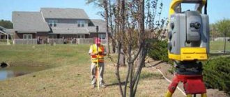
Is land surveying necessary? Yes, it helps to determine the real size and characteristics of the site. Of course, the cost of the procedure and related expenses are covered by the owner himself.
When a land plot can be registered as abandoned:
- if it was not initially registered;
- it is unknown whether there is an owner or who he is;
- there was an owner, but he renounced all rights;
- the object does not officially have an owner.
Then the municipality to whose territory it belongs will take over the site.
In principle, if this happens, then a citizen who is interested in this land will be able to obtain all the necessary information there. Therefore, he should definitely visit the local municipality.
Cadastral registration is not just an obligation, it is a guarantee that the plot actually has an owner. Its borders have been officially identified and secured. The cost has been calculated. After this, the owner is free to carry out any possible transactions. And the buyer will be able to obtain the basic information he is interested in regarding the land.
Is it possible to somehow find the owner through Rosreestr, even if he did not register the land? If the site has been registered at least once, specialists can look for old information in their archives. There will be information about the first, previous owner. Perhaps he will tell you who he sold or donated the land to.
Is it necessary to find the owner? Of course, how can you take land if its owner is unknown?
How to get a cadastral number
If the site does not and did not have a number, you will have to get one.
To obtain an individual number, you must write an application to the MFC or Rosreestr. Required package of documents:
- Passport.
- Certificate of ownership or extract from the Unified State Register of Real Estate (if available).
- A document confirming the rights to the site. This may be a purchase and sale agreement, an agreement of perpetual use, an agreement of lifelong inheritable ownership, a lease agreement, a deed of gift or a certificate of inheritance rights.
- Written consent from the municipality and from all tenants. It is necessary if the owner of the land is a municipality or the state, and land use is formalized by a lease agreement.
- Technical plan.
- Boundary plan.
- Permission from guardianship and trusteeship authorities. If there are minor citizens among the owners
package of documents for obtaining a cadastral number in .docx (Word) format. You must have title documents on the basis of which you own the land. If the site is old and the document for it is lost, you need to make a request to the BTI archive. At the MFC or Rosreestr branch you will be asked to fill out an application and pay a fee - 200 rubles for individuals, 600 rubles for organizations. The review will take about 20 days. On the appointed day, you must appear at the place where you submitted your application and receive an extract. You will need to provide a general passport and a receipt issued by the employee.
From January 1, 2021, cadastral passports and extracts from the Unified Register of Rights are replaced by one document - an extract from the Unified State Register of Real Estate.